

Sintaphu Tsho surface area shrinks 73% after GLOF
Satellite assessment shows the Himalayan glacial lake lost most of its water during the October 29 outburst in Gasa district.
 Climate Desk 2 min read
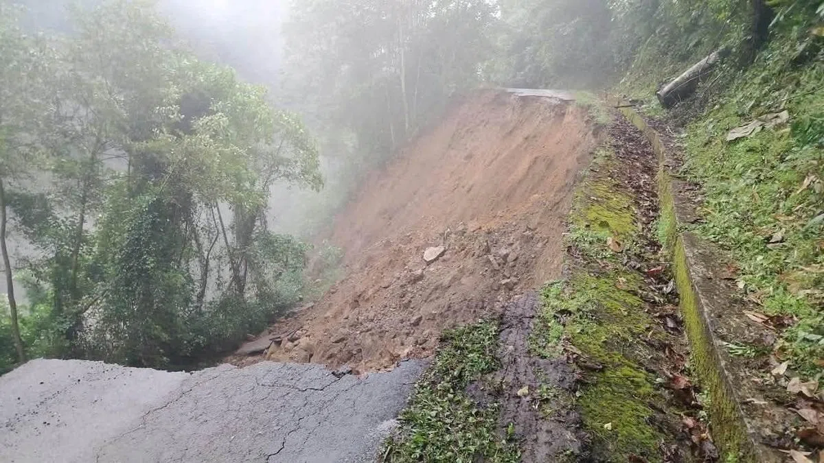
A satellite-based assessment of the glacial lake outburst flood (GLOF) in Bhutan’s Gasa district on October 29 revealed a 73% reduction in the surface area of Sintaphu Tsho. The lake, located at about 14,700 feet above mean sea level, experienced the most significant water loss during the outburst. Its surface area fell to 6.54 ha, which is less than a third of its size at any point in the previous ten years.
The outburst destroyed facilities at Gasa Tshachu, a natural hot spring along the banks of the Mo Chhu River. A part of the Punakha-Gasa highway was also washed away after the flood caused by the Shintaphu glacial lake bursting its banks on October 30, 2026.
Suhora Technologies, a Noida-based geospatial intelligence company, conducted a decade-long assessment of the lake system using satellite imagery from 2016 to 2026. The assessment shows a 24.4% reduction in the surface area of a supraglacial lake adjoining Sintaphu Tsho. This supraglacial lake, a temporary body of meltwater that collects in surface depressions on a glacier, fell to 12.47 ha but remains more than twice its 2016 size.
Sintaphu Tsho is located below Wakila Mountain in the Lungo area of Laya Gewog. Before the GLOF, Sintaphu Tsho remained stable, gaining 3.4% in surface area from 23.33 ha in 2016 to 24.13 ha in 2026, with the gain peaking on October 28.
“The findings highlight the importance of continuous monitoring of glacial lake systems and the role of satellite-based Earth observation in understanding changes across vulnerable Himalayan terrain,” said Krishanu Acharya, co-founder of Suhora Technologies. He added that timely access to such insights can support better awareness of evolving environmental risks and strengthen monitoring and preparedness across the region.
Key facts
- Sintaphu Tsho surface area fell to 6.54 ha after the October 29 GLOF, a 73% reduction.
- The outburst destroyed facilities at Gasa Tshachu and washed away part of the Punakha-Gasa highway.
- A nearby supraglacial lake shrank by 24.4% but remains larger than its 2016 extent.
Three perspectives
Neutral
Satellite imagery shows Sintaphu Tsho shrank by 73% following the October 29 glacial lake outburst flood in Gasa.
Positive
Krishanu Acharya, co-founder of Suhora Technologies, stated that satellite observations can support better awareness of environmental risks and strengthen monitoring.
Negative
The flood destroyed facilities at Gasa Tshachu and washed away part of the Punakha-Gasa highway.
Your week in news, every Wednesday
The biggest stories of the week for your edition, in your inbox every Wednesday morning, your time. Free, and you can unsubscribe at any time.